Geological exploration works
Vega LLC has extensive experience in performing geological and geophysical works by various methods: electrical exploration by magnetotelluric sounding (MT-AMT) and sounding by the formation of the TEM field, gravimetric works by its own fleet of modern gravimeters, as well as geochemical research by the passive adsorption method. The main types of tasks that we can solve:
- Solving structural problems in the search for hydrocarbons (oil and gas)
- Exploration of solid mineral deposits (gold, platinum, sulfides, kimberlite pipes, etc.)
- Exploration and delineation of hydrothermal vents
- Search for aquifers
- Monitoring of the state of the environment of national economic facilities
ㅤ
Method of magnetotelluric sounding (MT)
It is based on the use of variations in the Earth’s natural electromagnetic field as a probing agent. The Earth’s natural EM field is a source of electromagnetic variations in a wide frequency range, which makes it possible to study the geoelectric properties of the medium from the first tens of meters to the first hundreds of kilometers. MT and AMT methods are used for regional research, oil and gas exploration, and the search for solid mineral deposits and hydrothermal vents. In addition, the equipment used for MT-AMT operations is increasingly being used to solve the problems of EM monitoring of the environment.
Advantages of the MT method over other electrical exploration methods:
- One of the few exploration methods that does not have a negative impact on the environment
- Compact portable equipment set
- No cumbersome external signal source compared to methods with a controlled EM radiation source
- The greatest depth among all electrical exploration methods
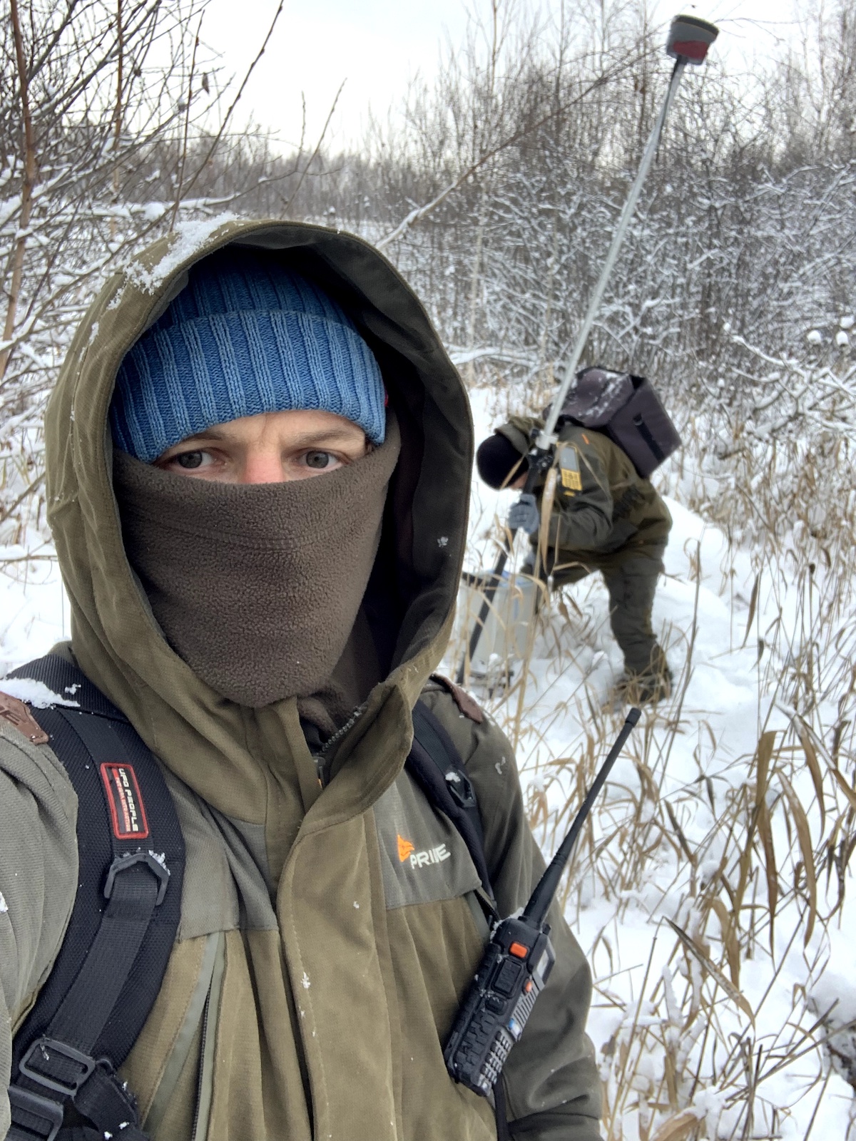
Equipment used by the company to perform electrical exploration work:
- VMTU-10 magnetotelluric station (developed and manufactured by VEGA LLC)
- NORD+ with sets of IMS series induction sensors (developed and manufactured by VEGA LLC and Nord-West LLC)
- Non-polarizing electrodes (developed and manufactured by VEGA LLC)


Methods of performing electrical exploration works:
All electrical exploration works are performed in accordance with the instructions for electrical exploration: “Instructions for Electrical Exploration”: Approved by the Government of the Russian Federation. Ministry of Geology of the USSR 24.12.81. – Leningrad: Nedra: Leningr. otd., 1984. – 352 p.
In addition, area or profile works are performed, depending on the terms of reference agreed with the Customer. The measurement frequency range (MT, AMT) is selected depending on the type of problem being solved. For the MT method, a 5-component cross-shaped setup is usually used to register two components of the electric field and three components of the magnetic field. If necessary, the technology of synchronous measurement can be used at several points with a remote reference measuring point (remote reference). This allows you to collect more information about the section under study, improve data quality by additionally filtering out uncorrelated noise, and increase productivity.
⠀
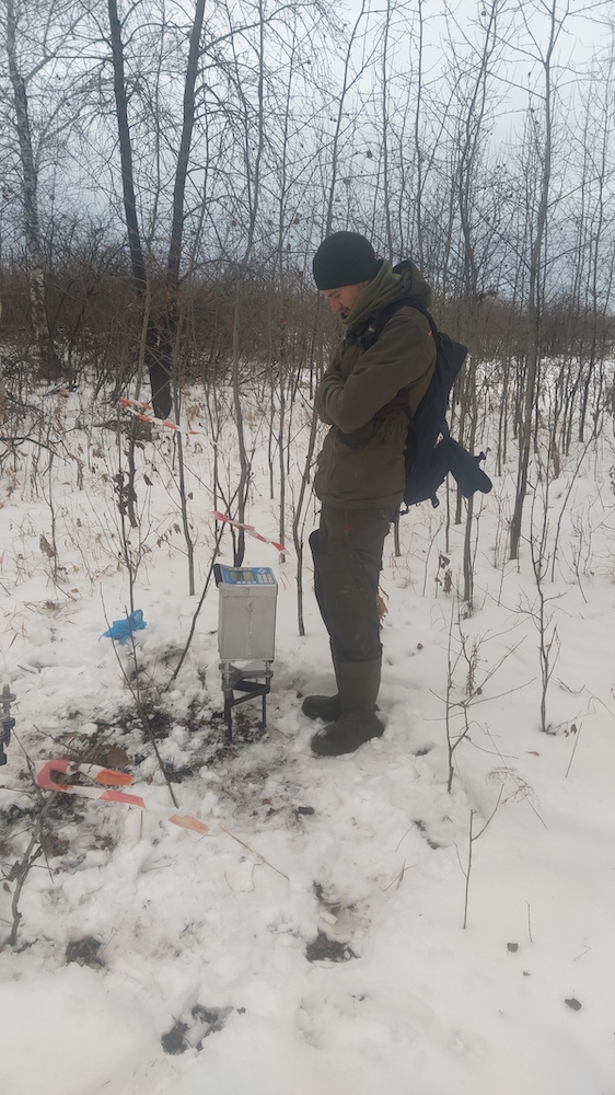
Gravimetric method
Gravimetry is a method of exploration geophysics based on the study of the gravity field and its gradients. The difference in the gravity field occurs due to different densities of geological features.
Advantages of the gravity exploration method:
- Relatively high performance
- High precision
- Possibility of studying the horizontal (lateral) heterogeneity of the Earth
- Depth of research from the first meters to several hundred kilometers
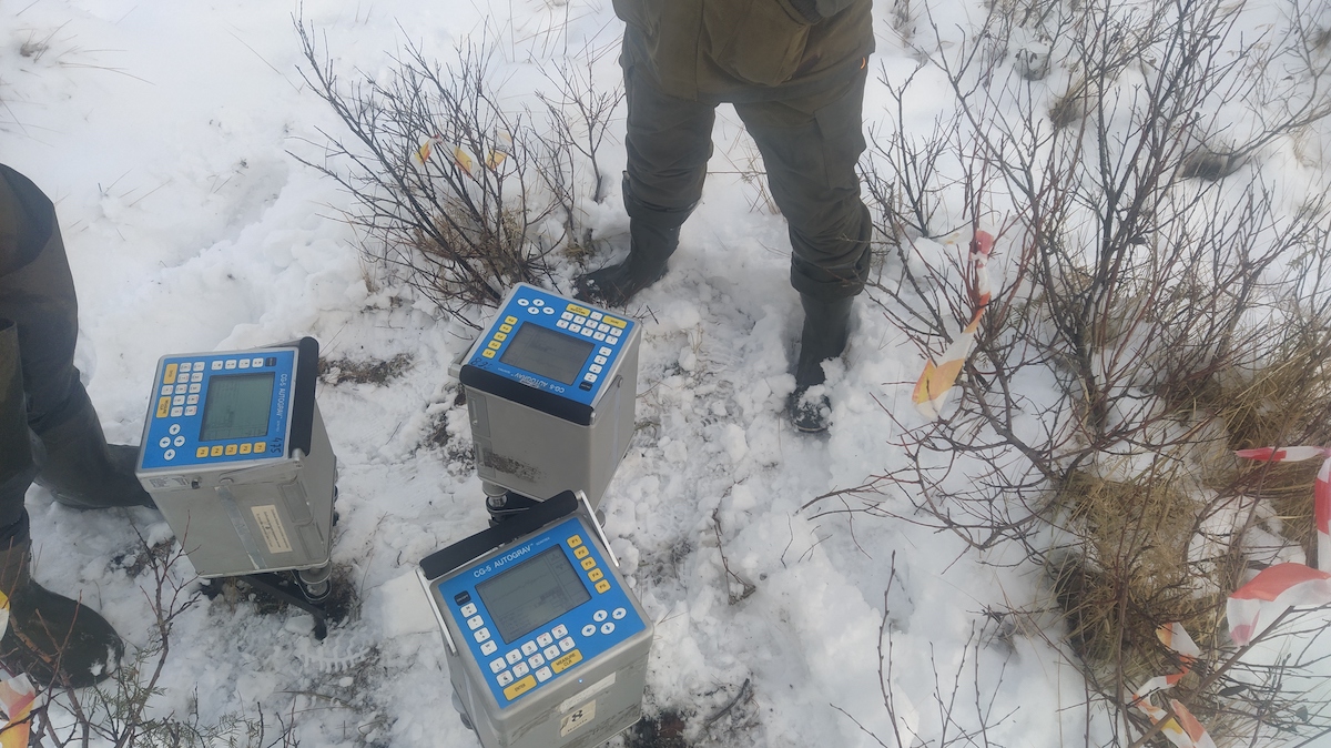
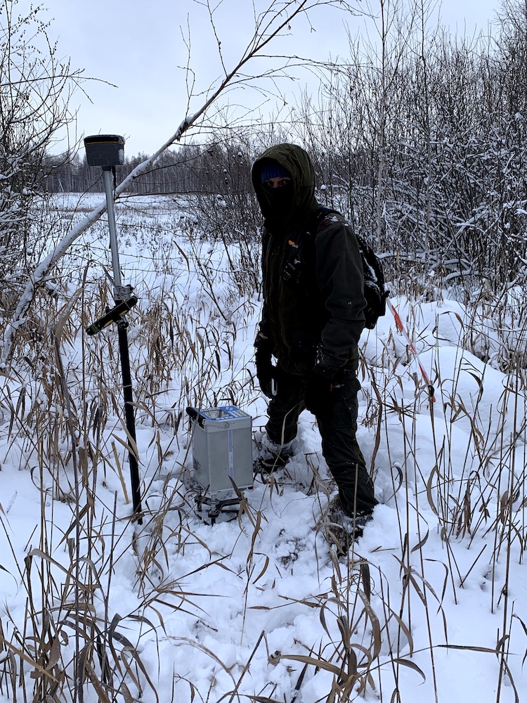
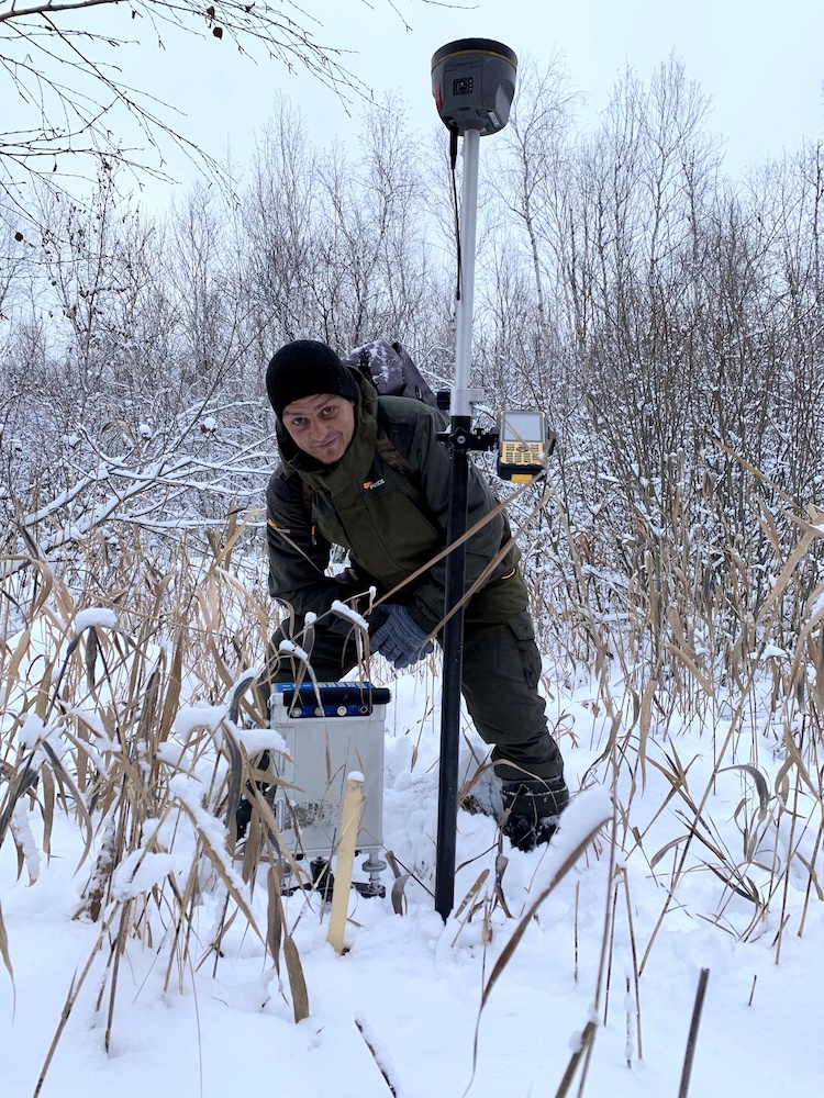
Equipment for gravity exploration:
The company has a fleet of modern high-performance automatic gravimeters SCINTEREX AutoGrav CG-5. All equipment undergoes regular metrological checks at the reference site with obtaining all necessary certificates, thereby confirming the reliability and accuracy of measurements.
Method of work execution:
Gravity field measurements at gravimetric observation points are made at a conditional (relative) level in pedestrian routes. To take into account the offset of the zero point of the gravimeter, a reference network is divided, including the central reference point and several intermediate reference points located in the immediate vicinity of the points of ordinary survey. To determine the planned altitude position of gravimetric observation points, topographic and geodetic works are performed with the accuracy of reference specified in the technical task by the GNSS complex of geodetic class equipment.